
From Norway’s misty mountain passes to the volcanic plains of East Java, some of the world’s best driving experiences begin well before sunrise — setting the alarm clock for them is definitely worth it.

Most road trips start at a reasonable hour. You pack the car, stop for coffee, and ease into the drive. But there is a different kind of journey, one that asks you to be somewhere dark and cold before the day has properly begun, and rewards you in ways that are hard to explain once you are back in daylight.
Sunrise drives are not for everyone. They require planning, an early alarm, and a willingness to move through darkness towards something you cannot yet see. What they give in return is quiet roads, extraordinary light, and a view of the world before the crowds arrive.
Here are five routes, across five very different landscapes, that are best experienced as the sky begins to change colour.
Mount Bromo, East Java, Indonesia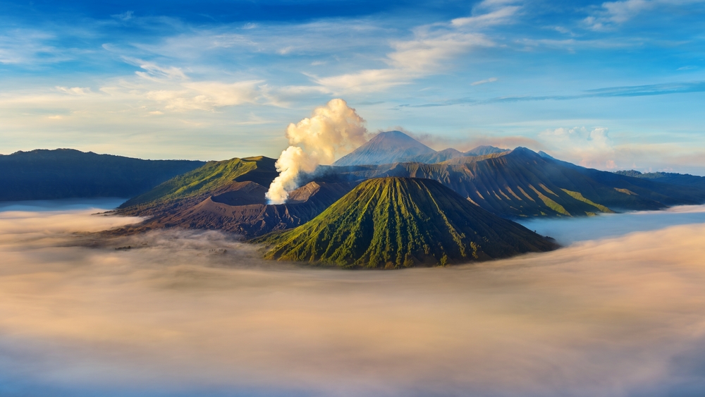
For Singaporeans, Bali is often the default Indonesian holiday. But a short flight to Surabaya opens up something far more dramatic. Mount Bromo, an active volcano within the Bromo-Tengger-Semeru National Park, sits at 2,329m above sea level in the middle of a vast ancient caldera known as the Sea of Sand. The drive and jeep transfer to the viewpoint are part of the experience.
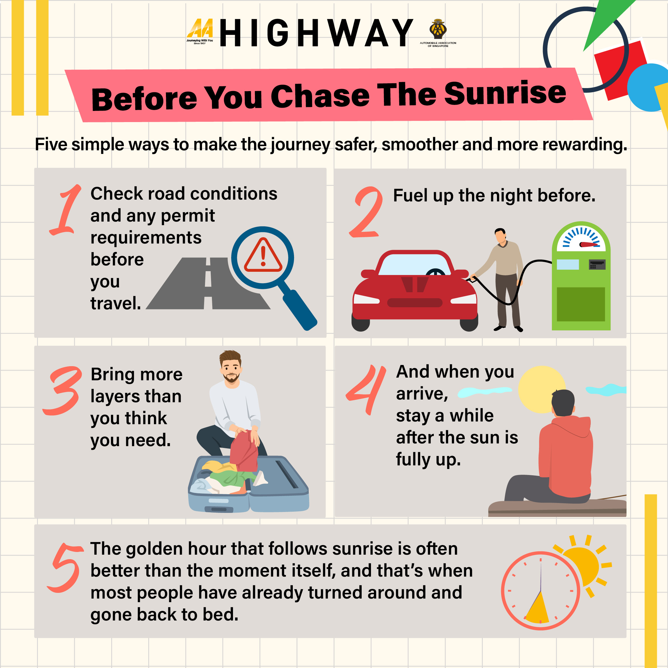
Most tours depart from Malang or Surabaya around midnight, giving you a two-hour drive before switching to a 4WD jeep at Cemoro Lawang village. Self-driving to Bromo is possible. You can drive your own or rental vehicle to Cemoro Lawang, where you then hire a local 4WD jeep for the final stretch into the caldera, independent jeep hire is available on arrival at the village. You reach the King Kong Hill viewpoint in darkness, usually by 4am. The temperature drops sharply at altitude, so layers are not optional. Then you wait.
When the sun rises, usually between 5am and 5.30am, the light hits the volcanic peaks in sequence. Bromo’s smoking crater appears through the mist below you, surrounded by the flat grey expanse of the caldera. Mount Semeru, the tallest volcano in Java at 3,676m, rises in the distance. The sky moves through shades of orange, pink and gold before settling into morning blue. After sunrise, jeeps drive down across the Sea of Sand to Bromo’s base, where a short climb of around 245 steps brings you to the crater’s rim.
The dry season, from April to October, gives you the clearest skies. Weekday visits are quieter than weekends. Guides are useful, particularly for understanding the area’s significance to the local Hindu Tenggerese community, who hold an annual ceremony at the crater called Upacara Kasada. This falls on the 14th day of the Kasada month in the traditional Tengger lunar calendar, typically between May and July each year. Note that the national park closes to visitors for 48 hours during the ceremony. There is no food or fuel within the national park, so fill up and eat before you set out.
Angkor Wat, Siem Reap, Cambodia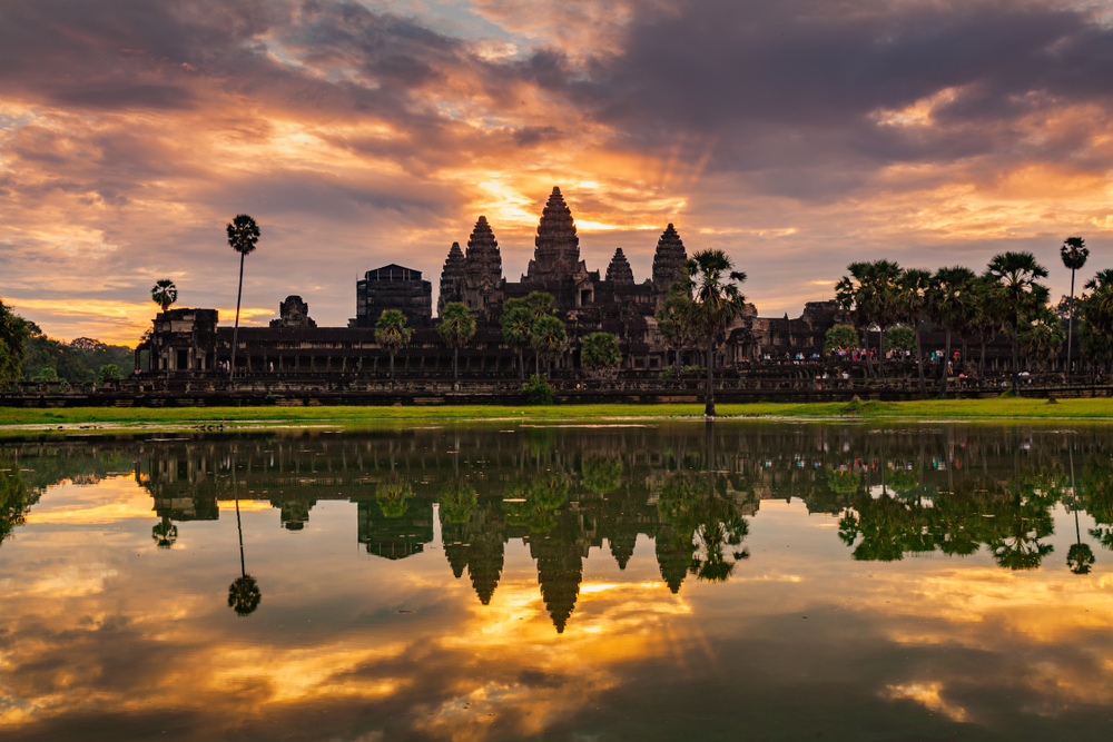
Angkor Wat is the largest religious monument in the world. Built in the early 12th century as a Hindu temple dedicated to Vishnu, it later became a Buddhist site and is now a UNESCO World Heritage Site. It is also, by a wide margin, the world’s most photographed sunrise location. There’s a reason for that.
From Siem Reap, the temple complex is about five kilometres north of the city centre. Since tourists can no longer self-drive within the park, a tuk-tuk or private car is the standard way to get there. Plan to leave your accommodation by around 4am. Leave around an hour before sunrise, accounting for the dark walk to your viewing position. Tickets must be purchased in advance at the official Angkor Enterprise office or online ; they are not sold at the gate. A one-day pass costs around US$37.
The view from the northern reflection pool is the iconic one. As the sky lightens, Angkor Wat’s five towers appear in silhouette against deepening shades of purple and orange, then reflect in the still water below. Arrive by 5am to secure a good position. The sky colours peak in the 30 minutes before the sun clears the horizon.
The dry season, from November to April, offers the clearest conditions. The wet season can cloud over quickly, leaving you with an expensive early alarm and nothing to show for it. If you get unlucky on your first attempt, a three-day pass gives you two more chances without additional cost. Food stalls outside the complex open early and serve breakfast from around 5.30am; stock up before heading in, as there is nothing available inside.
Haleakalā National Park, Maui, Hawaii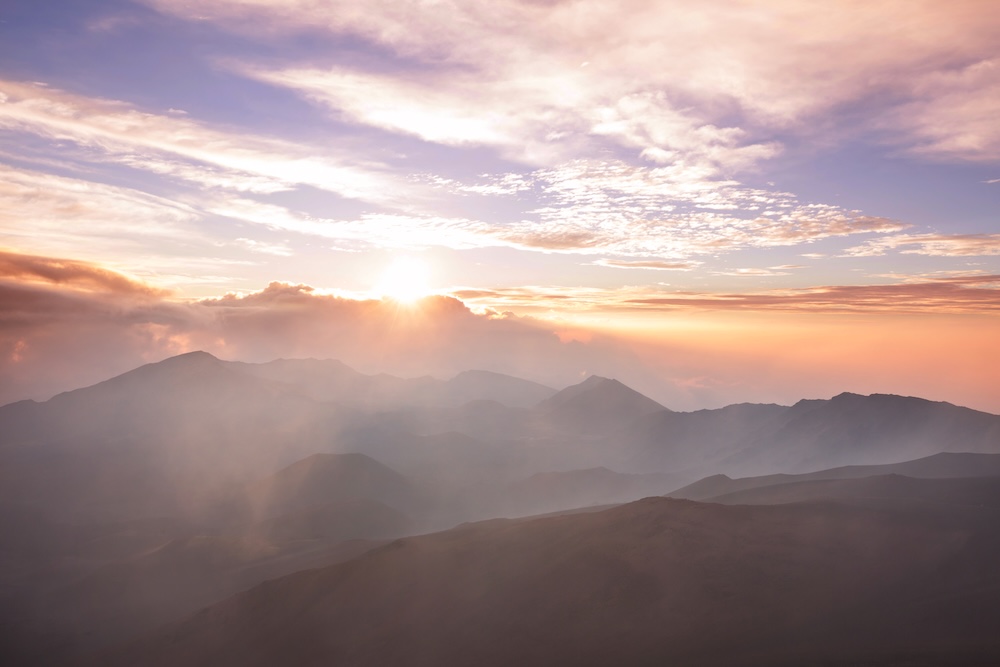
The name means “House of the Sun” in Hawaiian. At over 3,048m above sea level, Haleakalā is the world’s largest dormant volcano, and one of the few places on earth where you can drive from sea level to above the clouds in a single morning. Mark Twain described the sunrise here as the “sublimest spectacle” he’d ever witnessed. The drive itself earns that description.
From South Maui, the journey takes around two to two and a half hours. From West Maui, allow closer to three. Self-driving is the standard way to visit Haleakalā, and most visitors rent a car. The route follows Haleakalā Highway through upcountry farmland before joining Crater Road for the final 18km, which climb through 29 switchbacks to the summit at 3,055m. The road is well-maintained but steep and winding in darkness, so drive slowly and use low beam. Reservations are required to enter the park between 3am and 7am; they open 60 days in advance through Recreation.gov and sell out quickly, particularly in peak season.
The summit House of the Sun temperature sits around 5°C before dawn regardless of conditions at the beach below. Bring warm layers and don’t underestimate the cold. Summer sunrise is around 5.45am; in winter, it moves to around 7am. When the sun appears, the sky moves from deep indigo to fiery gold, with clouds floating far below the summit. You’re, quite literally, above the weather.
Linger after the sun is up. The Haleakalā crater, visible from the summit, reveals more detail as the light improves. No food or fuel is available within the park, so fill up and eat something before you leave.
Trollstigen, Western Norway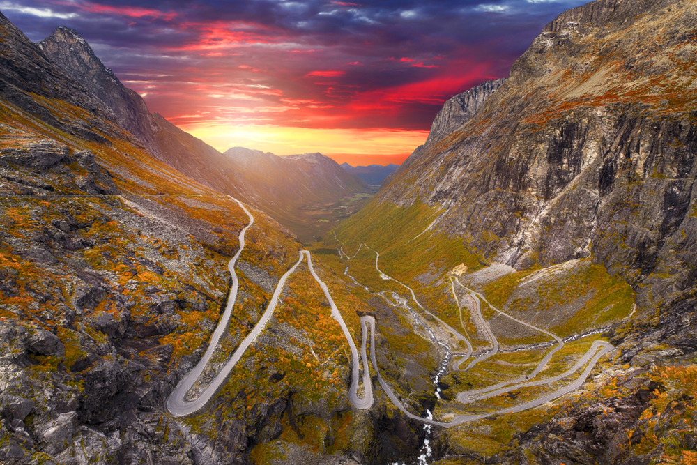
Norwegian legend has it that trolls roam the mountains by night and turn to stone when caught by sunlight at dawn. Standing beneath the sheer rock face of Trollstigen as the morning light arrives, it’s not difficult to see where the story came from.
Trollstigen, which translates as “Troll’s Ladder,” is a mountain road in the Møre og Romsdal region of Western Norway. It connects Åndalsnes and Valldal through 11 hairpin bends cut into an almost vertical rock face, climbing to 858m above sea level. The Stigfossen waterfall runs directly beneath one of the road’s bridges. Construction began in 1916 and the road was opened by King Haakon VII on 31 July 1936. It remains one of Norway’s most visited scenic routes.
In summer, Norwegian nights are short. The sun barely dips below the horizon, and dawn arrives early. Starting the drive before 8am means you beat the tourist coaches, which struggle with the tight bends and slow everything down considerably. Self-driving is the standard way to experience Trollstigen; no tour is required, though guided group tours are available from Åndalsnes if preferred. There is a visitor centre at the summit plateau with a café and toilets, but it may not be open early in the season, so bring your own food and water. The road forms part of the Norwegian Scenic Route Geiranger-Trollstigen, a 104km stretch that includes Geirangerfjord, a UNESCO World Heritage Site. Allow a full day for the complete route.
Trollstigen is a seasonal road, typically open from mid-May to October, depending on snowfall and conditions. It’s also prone to sudden closures from rockfall and landslides; always check the current status on vegvesen.no (Norway’s official roads authority) before planning your visit. The road reopened to drivers in July 2025 after a full-season closure for repairs in 2024. Check road status and closure dates before you leave home.
The Great Ocean Road, Victoria, Australia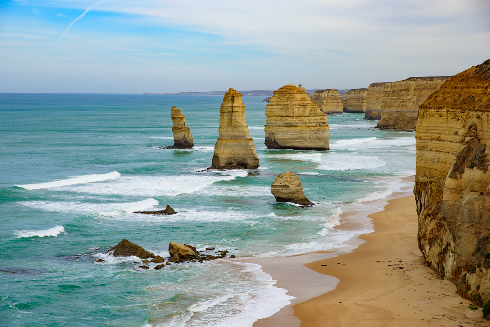
The Great Ocean Road is one of the world’s best-known coastal drives. Stretching along Victoria’s south-west coast from Torquay, roughly an hour from Melbourne, the road hugs clifftops above the Southern Ocean for 243km. The Twelve Apostles — named after 12 limestone stacks rising up to 45m from the sea — are the obvious draw, although only eight remain standing.
Self-driving is the preferred way to explore the Great Ocean Road, and most visitors rent a car from Melbourne. The road is well-signposted and straightforward to drive at your own pace. Guided day tours from Melbourne are also available if you prefer not to drive, and these typically include the main stops along the route.
Summer is the clearest season, though the road is worth driving year-round. If you are staying in Melbourne, the drive to theS Twelve Apostles takes around four hours. Allow two days for a comfortable return trip that lets you stop properly. Beyond the rock formations, the road passes Bells Beach, the Otway Ranges rainforest, and a stretch of coastline where koalas are often spotted in the roadside trees. Petrol stations and cafes are available at towns along the route, including Lorne, Apollo Bay, and Port Campbell, so plan your stops around these.
Before You Go
Every route on this list asks something of you before the reward arrives. An early alarm, a dark drive, or cold air before the warmth begins. What they have in common is that the drive itself is inseparable from the experience. You’re not just going to see a view; you’re moving through a landscape that changes around you as the light builds.
A few things apply across all of them.