Why do some destinations feel easy to explore, and others leave you exhausted before you’ve even started?
 Whether a city feels easy to move around in is rarely down to luck. It is usually the result of decades of decisions about pavements, train frequencies, crossings, street widths, shade, and whose needs were prioritised in the first place. For travellers, those decisions shape almost every part of the experience, often without them even realising it.
It’s Not About The Sights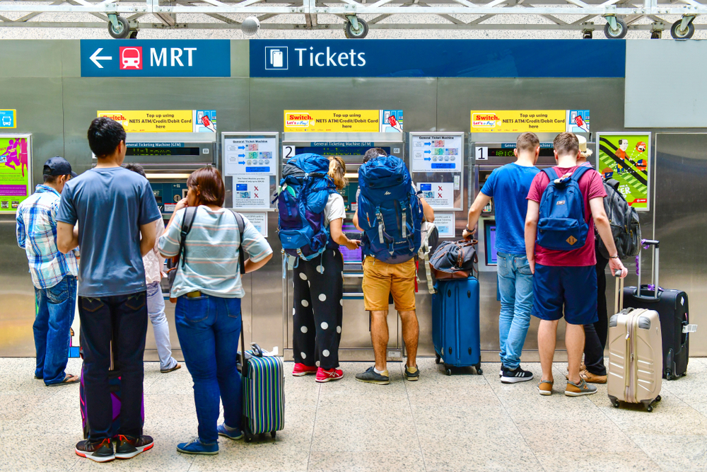
You know the feeling when a city just works. You step off a flight, find your bearings, and within an hour you’re outside exploring with confidence. The streets make sense, Public transport feels intuitive enough that you are not constantly reaching for your phone or wondering if you have taken the wrong turn.
Then there are the cities that fight you. You spend your trip stuck in traffic, hailing a taxi, standing on broken pavements, or waiting for a bus that never quite arrives. The sights might be spectacular, but the experience feels like work.
The difference is rarely about how beautiful or “exciting” a city is. It comes down to how it was designed and whether that design had the pedestrian in mind at all.
What Walkability Actually Means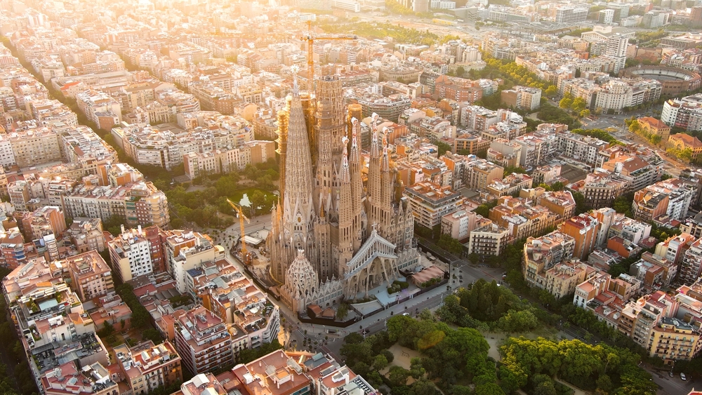
Walkability is not just about having pavements. It’s about whether those pavements are wide enough, shaded, connected, and actually lead somewhere useful. A city can technically have footpaths everywhere and still feel exhausting to navigate if crossings are inconvenient, shade is lacking, or walking routes suddenly end without warning.
The urban thinker Jane Jacobs argued in her landmark 1961 book, The Death and Life of Great American Cities, that good streets need activity at ground level: shops, homes with windows facing out, cafes with people in them, to feel safe and worth walking along. Streets that exist purely to move vehicles from one point to another may function efficiently for traffic, but they rarely create spaces people enjoy spending time in.
Cities like Copenhagen, Kyoto, and Barcelona do this well. Blocks are short, so you can see what’s around the next corner. Ground floors are active, there’s always something to look at, and the streets are scaled for people, not vehicles. In contrast, cities built primarily around the car treat walking as an afterthought. This includes large parts of suburban Southeast Asia, much of the Gulf region, and sprawling North American metros. Pavements, where they exist, are narrow, poorly shaded, and interrupted without warning by car parks or slip roads.
Singapore sits somewhere in the middle. Its covered walkways: the five-foot ways inherited from its shophouse era, and the more modern sheltered linkways, are genuinely practical in a tropical climate. In areas like Marina Bay, Chinatown, and parts of Orchard Road, pedestrians can move comfortably between MRT stations, malls, offices, and attractions with relatively little friction. But outside the city centre and older neighbourhoods like Tiong Bahru or Joo Chiat, the experience can still feel car-oriented. Sheltered paths sometimes end abruptly between developments, crossings are spaced far apart, and long exposed stretches become uncomfortable in the midday heat.
Transport as a Confidence Builder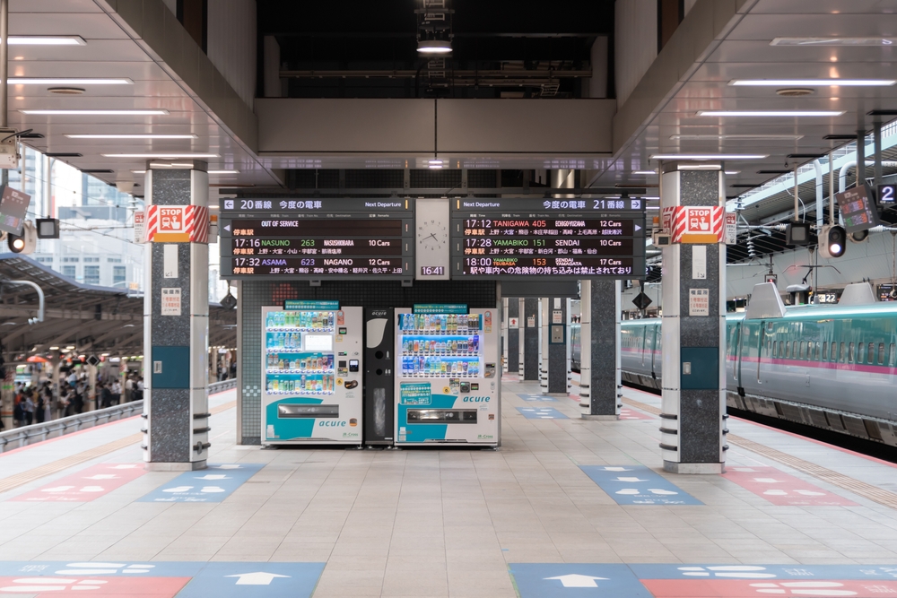
A good transport network does more than move people. It gives travellers confidence. When trains arrive predictably, ticketing systems are easy to understand, and stations are clearly signposted, visitors become more willing to explore beyond the main tourist districts. The psychological cost of getting lost feels lower, which changes how people experience a city.
Tokyo is the obvious example. Its rail network is famously complex, but once understood, it is extraordinarily freeing. Travellers routinely go further, stay longer in neighbourhoods, and spend more at local businesses, because getting around is manageable. Many come back for the same reason. A city that feels easy to navigate rewards repeat visits, because there is always another district to discover. Vienna, Zurich, and Hong Kong work the same way: integrated ticketing, frequent services, and clear signage make public transport the obvious choice over a taxi.
Cities that neglect their transport infrastructure while relying on tourism pay a price. Manila, for instance, draws millions of visitors to its historic districts and islands, yet patchy public transport and gridlocked roads keep many of them clustered in a handful of tourist zones. Cairo faces a similar challenge, where an underserved metro and chaotic surface traffic discourage independent exploration beyond the most visited sites. Visitors cluster around well-known landmarks because venturing elsewhere feels too hard. Businesses outside the tourist core lose potential customers and income.
According to the Economist Intelligence Unit’s Global Liveability Index, the cities that consistently attract the most repeat visitors are also those with the most integrated transport networks. Vienna, which regularly tops the index, welcomed over 17 million tourists in 2023. Cities of comparable size but with weaker transport infrastructure attract a fraction of that number. The city’s real character, which is rarely found in its most-photographed spots, goes unseen.
Singapore’s MRT is, by most measures, one of the most efficient urban rail systems in the world. Trains are frequent, air-conditioned, and clean, while fares remain relatively affordable compared to many major cities. For first-time visitors, the colour-coded map and bilingual signage remove a huge amount of friction. The system is one of the reasons Singapore performs strongly in international liveability and traveller satisfaction rankings, even if the city itself is not always seen as the most spontaneous destination.
Reading A City Like A Map
The urban planner Kevin Lynch, in his 1960 book The Image of the City, introduced the idea that people navigate cities through mental maps built from landmarks, paths, and districts. A legible city is one where those elements are clear. You know where you are relative to where you want to be.
Paris is often cited as one of the most legible cities in the world. The Seine divides it cleanly, the arrondissements spiral outward in a logical sequence, and major landmarks remain visible from a distance, giving you a constant sense of where you are. Compare that with cities that grew without planning, or were rebuilt hastily after rapid industrialisation, where street patterns can feel random and disorienting even with a map open on your phone.
Singapore’s district structure: Orchard, Marina Bay, the CBD, Chinatown, Little India, and Kampong Glam, gives visitors a useful mental framework. The MRT map, colour-coded and logically laid out, reinforces that sense of orientation. But the city’s relentless urban renewal has erased many older reference points. The National Library on Stamford Road, demolished in 2004, and Rochor Centre, cleared in 2016, were structures that anchored specific parts of the city in the minds of regular visitors. Their replacements, though functional, are harder to distinguish from one another. Some newer districts look similar enough to be hard to distinguish, and the constant change can leave even frequent visitors slightly disoriented.
Where Cities Go Wrong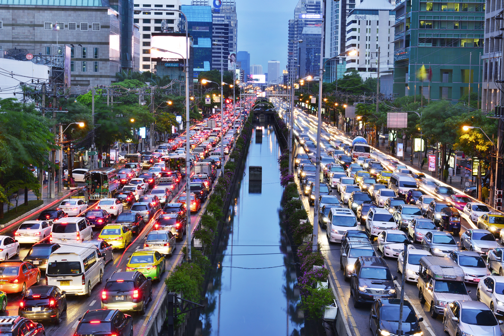
Not every failure of urban design is deliberate. Many cities simply grew faster than their infrastructure could handle. Bangkok’s notorious traffic exists not because planners were indifferent, but because the city expanded at a pace that planning could not keep up with. Its elevated rail network now provides real relief, but large parts of the city remain difficult to reach without a car or motorbike, and the walking environment between stations is often hostile.
Other failures reflect deliberate choices made at a different time, when car ownership was seen as progress. Roads were widened, pavements were narrowed or removed entirely, and retail retreated into malls ringed by surface car parks. The result is a city that works for residents who drive but alienates everyone else, including visitors. Parts of Kuala Lumpur illustrate this well. Distances that appear short on a map can become surprisingly difficult on foot because roads are too wide, crossings too few, and shaded walkways inconsistent. Visitors often end up relying on Grab rides for journeys that would otherwise be comfortably walkable in a more pedestrian-friendly city. The result is a place where people move between isolated destinations rather than experiencing the city continuously at street level.
There is also the question of maintenance. A city can have excellent infrastructure on paper, but let it deteriorate. Broken lifts in metro stations, cracked pavements, and poor lighting erode the confidence of anyone trying to navigate independently. This is where the gap between “great infrastructure in theory” and “great experience in practice” often opens up.
What Travellers Are Actually Looking For
Most travellers do not consciously think about urban design. They simply know when a city feels comfortable to be in. They describe it as “easy”, “relaxed”, or “the kind of place you can just “wander”. What they are usually responding to is a city with good bones: human-scale streets, reliable transport, clear signages, shade, and public spaces that make spending time outdoors feel natural rather than stressful.
The cities that consistently score well in liveability and tourism satisfaction surveys — Vienna, Tokyo, Amsterdam, Singapore, Zurich — tend to share these qualities. They’re not always the most dramatic or spectacular. But they’re the ones where the infrastructure gets out of the way and lets the experience happen.
Research from the Victoria Transport Policy Institute has found that walkable environments increase visitor spending, encourage longer stays, and improve overall traveller satisfaction. Visitors in walkable cities tend to explore more neighbourhoods, enter more businesses, and spend more time outdoors compared to travellers navigating car-dependent destinations. The economics reinforce what the experience already suggests: people stay longer in places that are pleasant to move through.
The Design Behind The Experience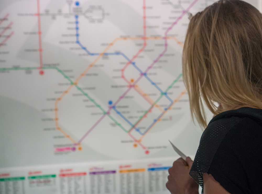
Great cities are not just visited. They’re navigated, figured out, and understood gradually. The ones that stay with you are usually the ones that made that process feel natural rather than stressful. That’s not an accident – it’s the result of decisions made by planners, politicians, and communities over decades about where to put the pavements, how often to run the trains, and whether the street belongs to cars or to people.
For Singapore, which has long positioned itself as a regional travel hub, the infrastructure is clearly there. The MRT network is efficient, reliable, and easy to navigate. But outside certain pockets, the street-level experience can still feel more practical than inviting. Singapore excels at moving people quickly, yet speed and efficiency are not always what make a city memorable. As the city continues to evolve, the greater challenge may not be building faster connections, but creating streets and public spaces that make people want to stay awhile.
The cities that earn a return visit are rarely the ones with the longest list of things to see. They’re the ones that made you feel comfortable enough to go looking.